Log in
All resources
Create a design
61 Free Artworks of 1550 Maps
maps by sebastian münster
bibliothèque nationale de france
1550s maps of the world
battista agnese
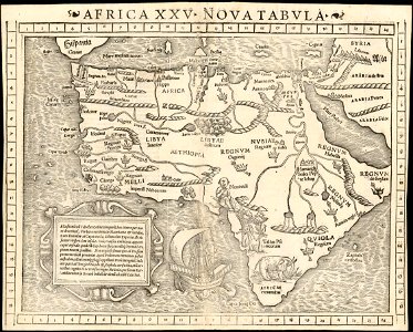
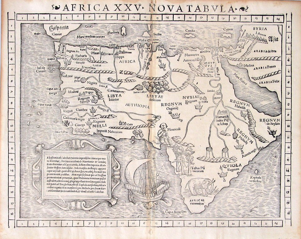
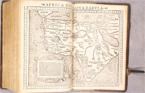
1550s maps of africa
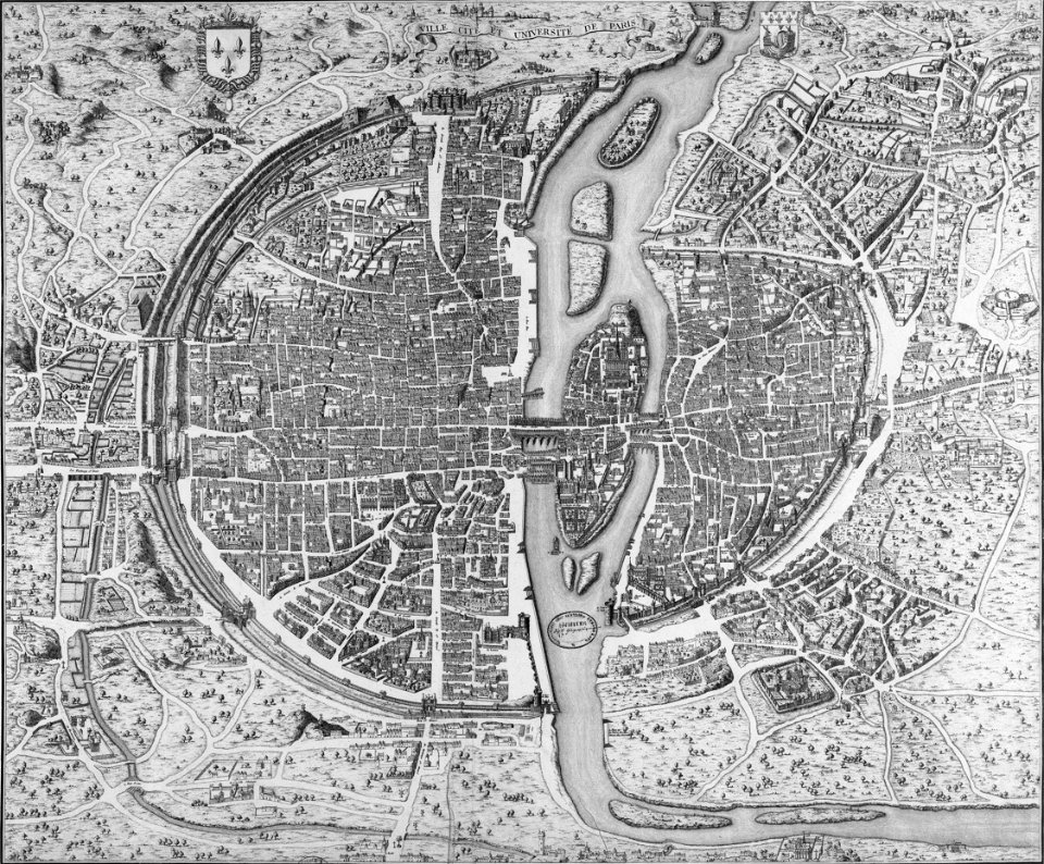
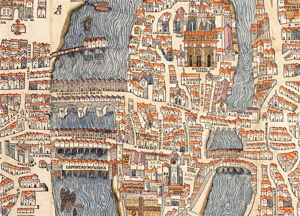
dheulland map of paris
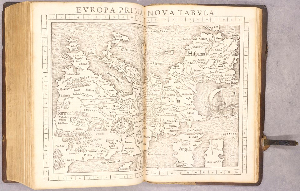
1550s maps of france
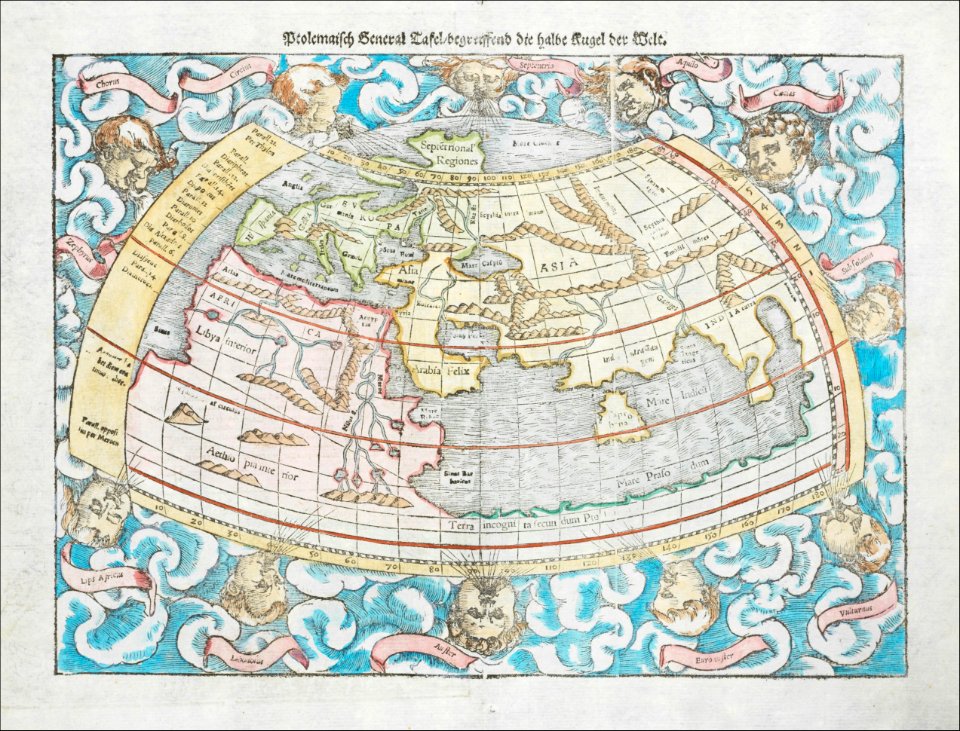
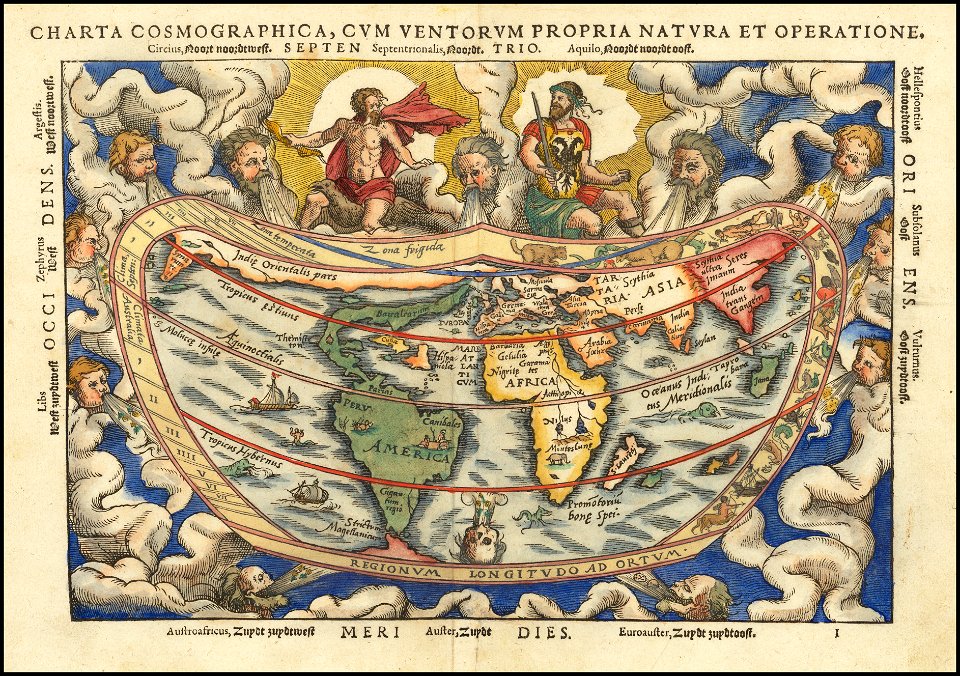
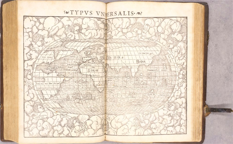
ptolemaic world maps
illustrations of cosmographia (münster)
1552
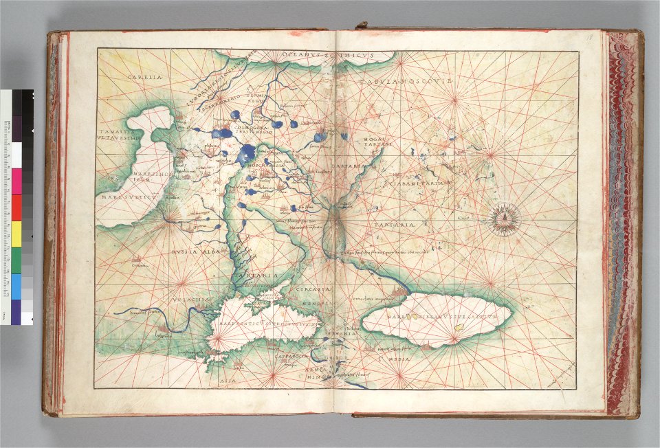
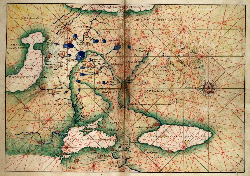
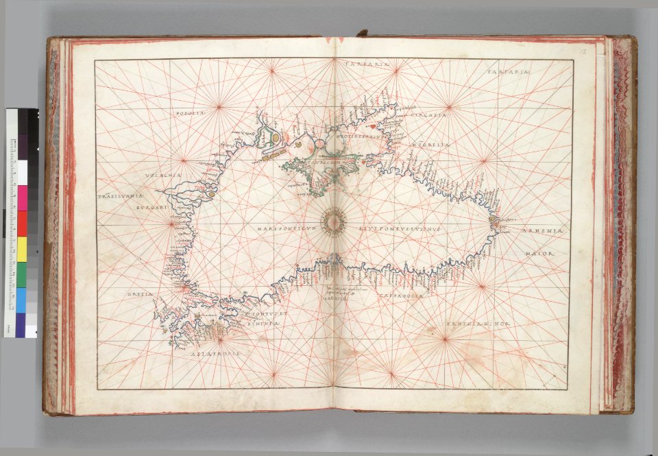
16th-century maps of the black sea
battista agnese
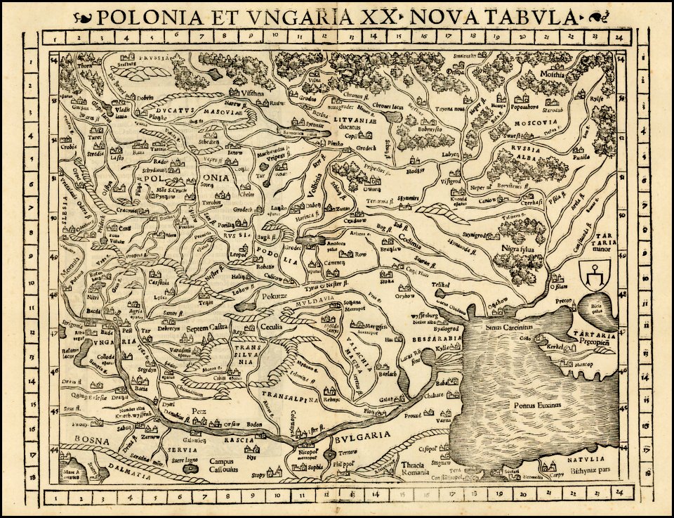
maps by sebastian münster
ptolemaic world maps
latin-language book pages
ptolemaic world maps
maps by sebastian münster
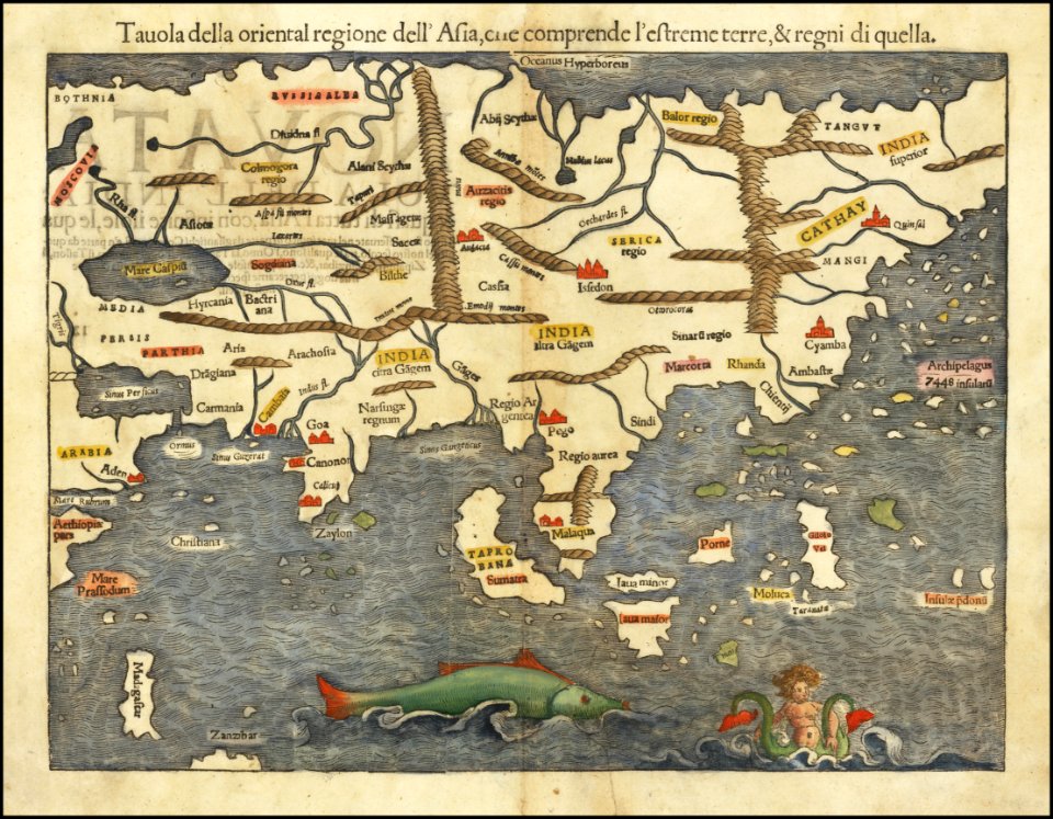
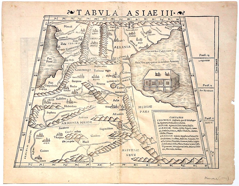
1550 maps of asia
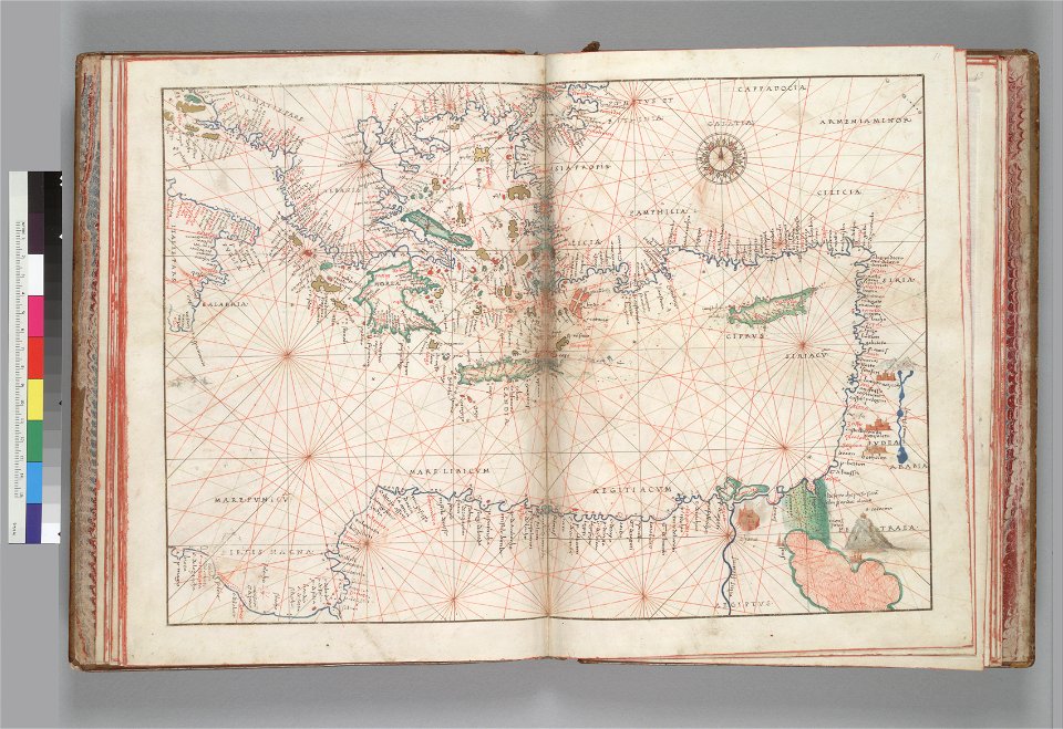
old maps of the middle east
old maps of greece
1550s maps of russia
battista agnese
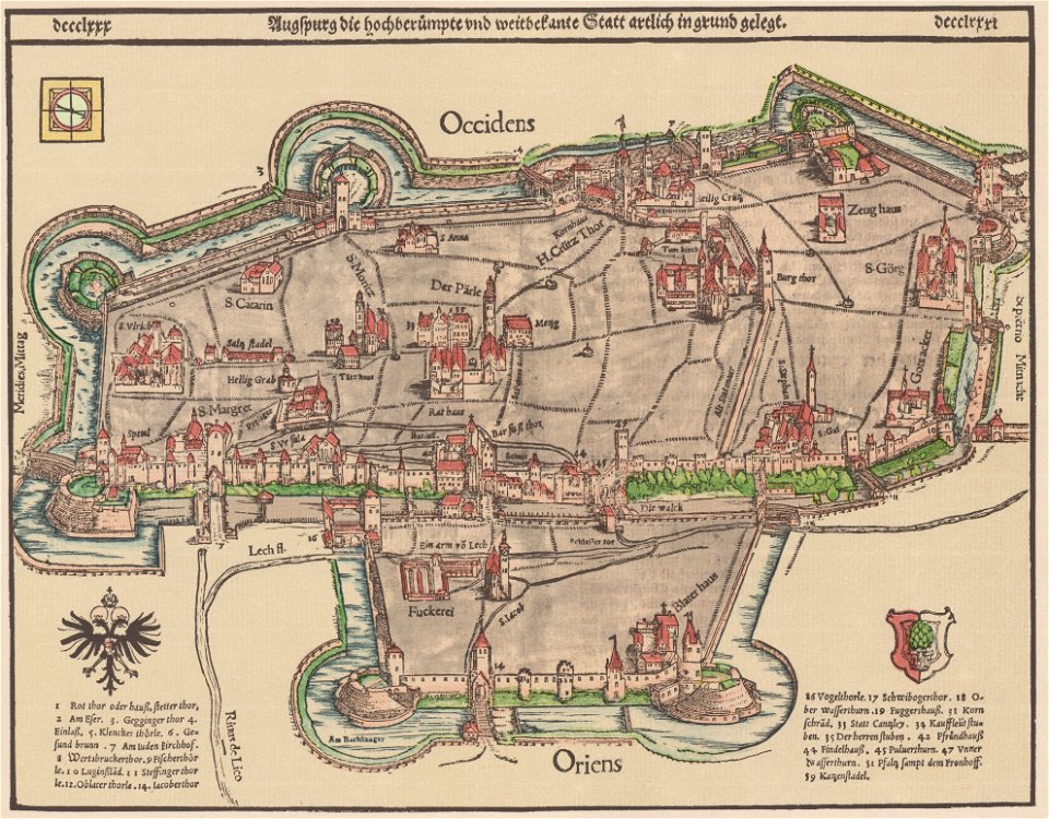
1550s maps of augsburg
german-language maps showing history of europe
maps by sebastian münster
illustrations of cosmographia (münster)
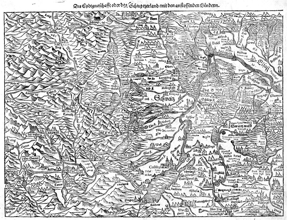
old maps of switzerland
maps by sebastian münster
1550 maps
16th-century maps of the black sea
battista agnese
maps by sebastian münster
old maps of crimea
maps by sebastian münster
1550s maps of africa
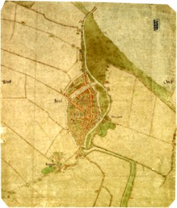
maps by jacob van deventer
old maps of brielle
charts and maps of the royal museums greenwich
1550 maps
16th-century maps of georgia
maps by sebastian münster
maps by sebastian münster
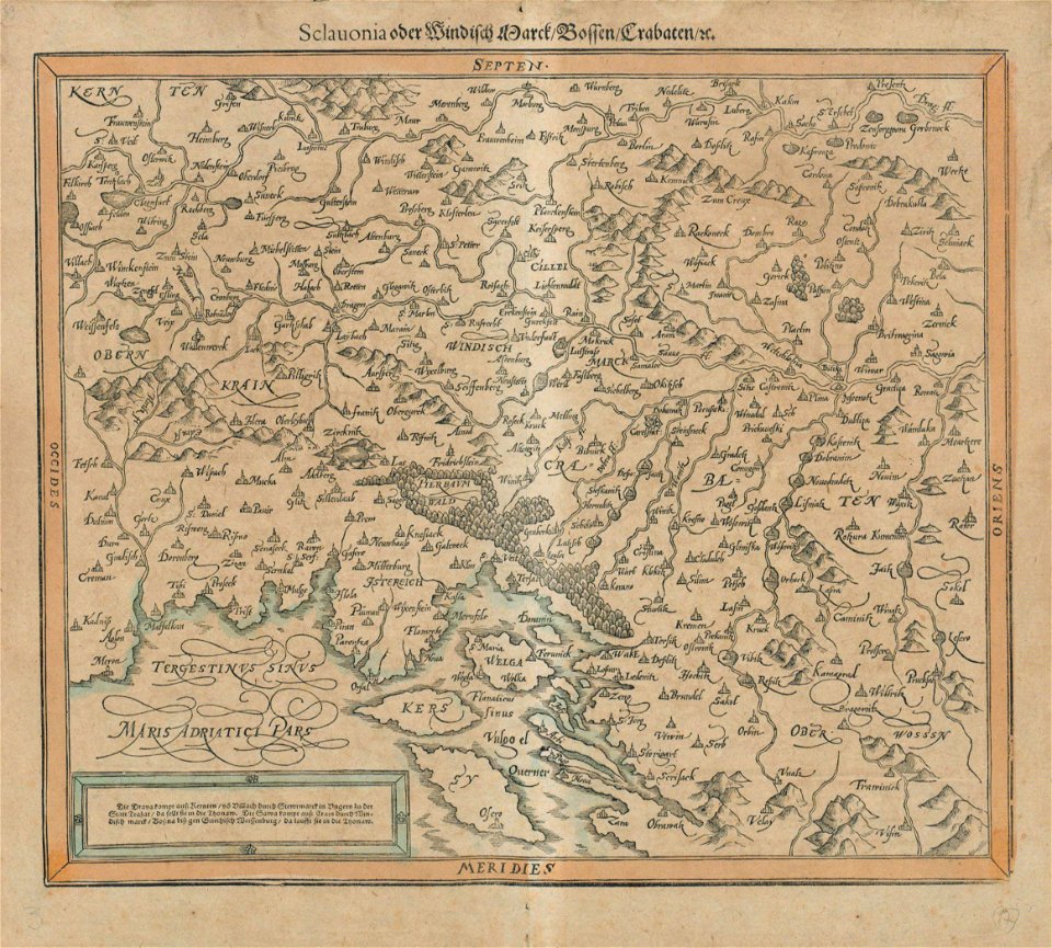
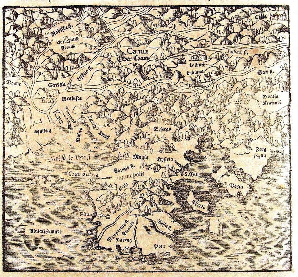
old maps of croatia
maps by sebastian münster
ptolemaic world maps
illustrations of cosmographia (münster)
1550s maps of africa
1550s maps of the world
petrus apianus
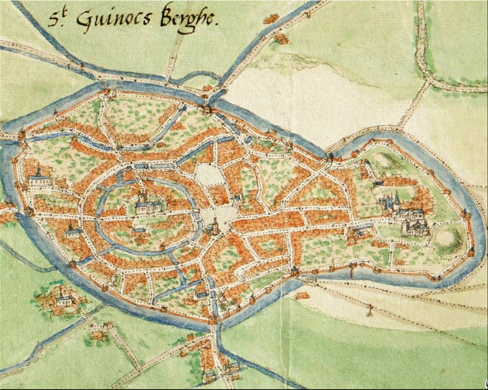
map of bergues by jacob van deventer
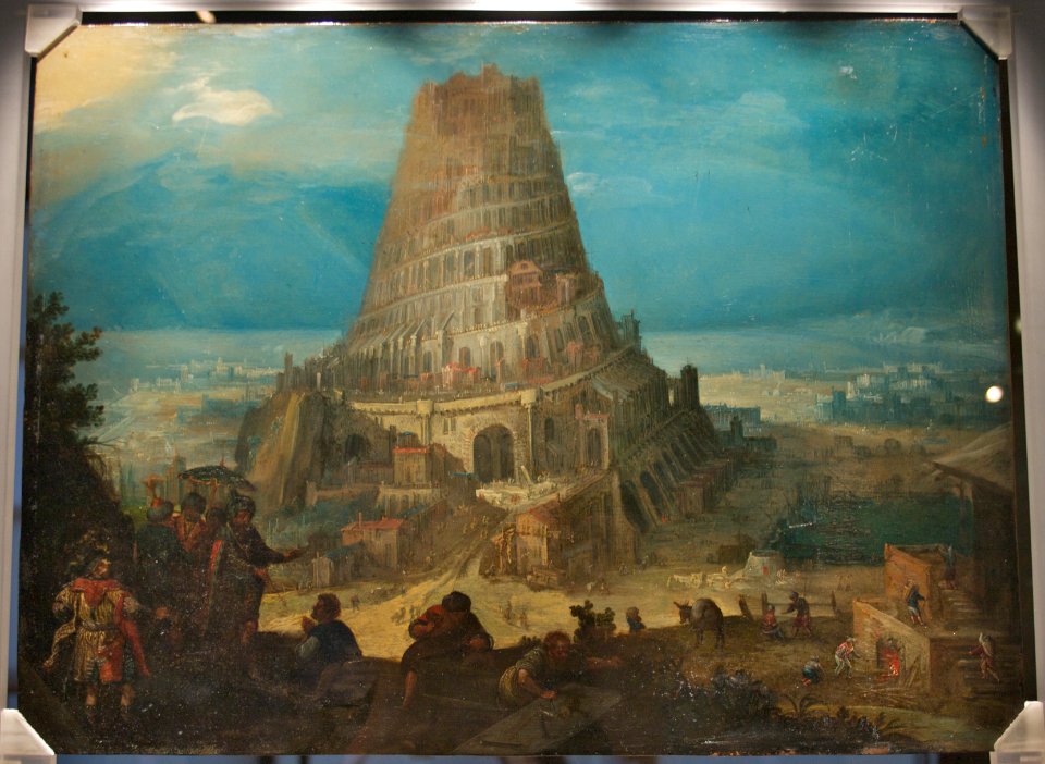
tower of babel in paintings
printmaking matrices
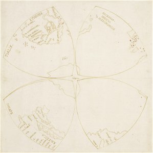
map of the northern hemisphere in four segments (rcin 991393)
map of gouda by jacob van deventer
huize groeneweg
heinrich petri (printer)
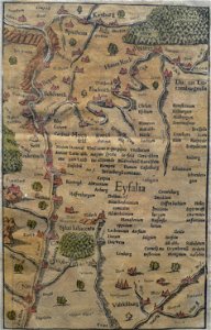
eifel
1550s maps of africa
1552
1550s maps of the world
1552
geographiae claudii ptolemaei alexandrini (münster
1552
dheulland map of paris
chartreuse de paris
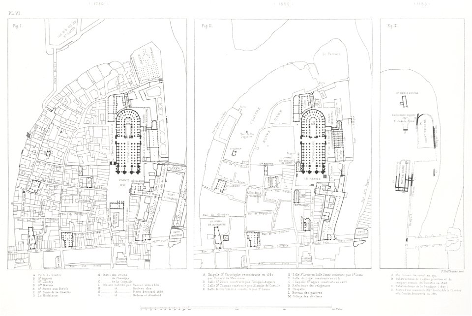
paris in the 16th century
lithographs of paris
historical images of the pont saint-michel
rue de la huchette (paris)
1550s maps of the iberian peninsula
renaissance
hôtel du petit-bourbon
old submaps of paris
16th-century maps of london
maps of old london (book)
16th-century maps of london
maps of old london (book)
16th-century maps of london
maps of old london (book)
historical images of abbaye de saint-germain-des-prés
foire saint-germain on old maps
maps from the mechanical curator collection available to georeference
maps from the mechanical curator collection
1550s maps of the iberian peninsula
1550s maps of france
frankfurt (oder) city bridge before 1819
oder river in frankfurt (oder)
map of paris by truschet and hoyau - derivatives files
église saint-sulpice on old maps
maps of paris from bibliothèque nationale de france
bird's eye view maps of paris
speculum romanae magnificentiae (mirror of roman magnificence)
1555
1570s maps of africa
1570s maps of egypt
christian sgrothen
ewijk
lutetia parisiorum urbs, toto orbe celeberrima notissimaque caput regni franciæ by sebastian münster
maps of paris from bibliothèque nationale de france
map of paris by claes jansz. visscher - derivate files
historical images of bièvre river in paris
16th-century maps of amsterdam
maps by jacob van deventer
old maps of astypalaia
giacomo franco
münster-holzschnitt trier
martinskloster (trier)
bibliothèque nationale de france
dheulland map of paris
bibliothèque nationale de france
dheulland map of paris
urban landscapes in the archives municipales (lyon)
lyon in the 16th century
maps of groningen by braun & hogenberg
high renaissance
pirro ligorio
john vi, count of nassau-siegen in paintings
baroque
high renaissance
oronce fine
high renaissance
pirro ligorio
male portrait paintings by wybrand de geest
baroque
maps of barbary coast by mercator-hondius
capture of mahdia (1550)
huis ter kleef in art
old maps of haarlem
1 - 61 of 61
/ 1


![Totius Galliae Descriptio cum parte Angliae, Germaniae, Flandriae, Brabantiae, Italiae Romam usque, Pyrrho Ligoric Neap. auctore. [1: 3 585 000 environ]. Sebastianus a Regibus Clodiensis incidebat, Pirro Ligorio, 1558](https://cdn.creazilla.com/illustrations/10000285804/totius-galliae-descriptio-cum-parte-angliae-germaniae-flandriae-brabantiae-italiae-romam-usque-pyrrho-ligoric-neap-auctore-1-3-585-000-environ-sebastianus-a-regibus-clodiensis-incidebat-pirro-ligorio-1558-md.jpg)


